Tuesday, October 31, 2006

Morning walk


Milo and I left for our morning walk around 7AM.  It's nice to walk in the sunlight again.  It was a very cool, 19 degrees.  Milo bounced down the driveway, ran ahead of me and was waiting at the flag pole when I arrived.  We raised the flag, saluted, and continued on our walk. 

There was no sign of the Halloween party held for the children on last Saturday.  They had games and prizes in the school house, and a hay ride.  Since the fire house burnt down, there is no power to the school house, hence, the party went from 1PM to 4PM.

There were a couple of adult parties around the neighborhood.  The band (Star Route) played at Steve and Julies.  It must have been a really good time.  The place was packed.  I kind of  remember walking home.

Milo wanted me to remind you that today is Sharon's birthday (Golf and Other Stuff) .  Hop over and wish her a happy day.  Sharon

I would like to welcome Sunshine residents Dr. Bruce and Dr. Joyce to my journal.  I hope you enjoy the winter in California.  The neighbors are looking forward to seeing you next summer.

Wednesday, October 25, 2006

Northern Wyoming and Yellowstone


Unlike the desert of southern Wyoming, northern Wyoming is a mixture of beautiful mountains and grasslands.  Moving from east to west, you leave the Black Hills into the Thunder National Grassland.  At Buffalo and Sheridan you enter the Big Horn Mountains.  Buffalo is the county seat of Johnson county, location of the famous Johnson County War between the open range ranchers and the homesteaders.  It's quite a story.  The Wyoming Stock Growers Association wheeled as much power as the state legislature (several people were members of both)  It is reported that the WSGA hired some Texans to run the homesteaders out of Johnson county.  Some of the settlers were murdered but they rose up and surrounded the cattlemen.  The US Calvary arrived and escorted the ranchers to the safety of a jail and everything quieted down.  The book "The Banditti of the Plains" by A.S. Mercer was written about the incident.  In the 1900's the books were destroyed and it was dangerous to own a copy as late as the 1950's.  My grandfather hid his and only a few people in the family knew of his acquisition.

North of Sheridan, in Montana, is the Little Bighorn Battlefield National Monument, location of the battle between Gen. George Custer and the Indians (Lakota Souix and the Northern Cheyenne).  Although not in Wyoming, a trip to Sheridan would not be complete without visiting the battlefield. 

Sheridan is also the headquarters for the International Association of Turtles.  For those of you who are Turtles,no explanation is needed.  For those of you who would like to know more click here.  There is only one correct response to the question, are you a turtle?


West of the Big Horn mountains is the Big Horn River and the Big Horn Basin containing the towns of Lovell, Greybull and Worland; the smaller towns of Basin, Ten Sleep and Meeteetse.....  And then there is Powell and Cody, the east entrance to Yellowstone National Park.  Cody was founded by William F. Cody (Buffalo Bill) in 1897.  It is the location of the Buffalo Bill Historic Center and the Whitney Gallery of Western Art (containing many Charley M. Russell paintings...my favorites).

The northwestern corner is the home of The Grand Teton and Yellowstone National Parks.  Yellowstone is probably one of the best know of the national parks, for it was the first.  Thank you Teddy Roosevelt.

Here are several photos I would like to share.  My father took these pictures in 1953 when he returned from Korea with his brand new 35mm camera.  Many of them were framed and hung in my parents house for years.  The original photos are on slides.

Yellowstone lodge before the fire.  The lodge survived but the forest didn't.


Old Faithful gyser.  I have a funny story about my friend Chris and his trip to Old faithful.  I'll share it on the Teton Post


Lower falls of the Yellowstone River.


Elk or Wapiti

Our next visit to Wyoming will be Jackson Hole and the Teton Mountains.  Until then, remember, life ain't about how fast you run, or high you climb, but how well you bounce. 

Don't squat on your spurs!


Tuesday, October 24, 2006

Tagged by Amanda

I've been tagged by Amanda.  I've seen this going around and have read some very interesting entries.  Amanda's post had me ROFL!  So.....here goes............


- - - - - - - - - - - - - - - - - - - - - - - - - - - - - - - - - - - - - - - - -
1. Grab the nearest book.

2. Open the book to page 123.

3. Find the fifth sentence.

4. Post the text of the next 4 sentences on your Blog along with these instructions.

5. Don't you dare dig for that "cool" or "intellectual" book in your closet I know that is what you were thinking!

6. Tag 4 or 5 people

- - - - - - - - - - - - - - - - - - - - - - - - - - - - - - - - - -
Taken from the current book, (I'm actually in the middle of three books but this is the one I can't put down) "Walking The Bible" by Bruce Feiler

"The distance between Jerusalem and Cairo is almost impossible to measure.  By foot it should take about a month, by camel two weeks, by bus a day.  But for most of history, such conventional means rarely worked.  Abraham made it faily easily, as did Mary and Joseph when they fled Bethleham with the baby Jesus to escape the wrath of Herod."

I won't tag anybody but I do find it fun to see what others are reading.

Sunday, October 22, 2006

Following The Oregon Trail

The early settlers of the American west mostly traveled through Wyoming without staying.  They followed known rivers to a point that they could easily cross the continental divide.  On the other side of the continental divide they would follow the rivers that flowed west to the Pacific Ocean, and their final destination, Utah, California or Oregon.  The three main trails that cut across Wyoming are the Oregon, the Morman and the California trail.  As I mentioned in an earlier post, they followed the North Platte river.  You can still find wagon wheel ruts and places where the early pioneers carved their names in the sandstone cliffs.  On the south side of the North Platte, across from Fort Laramie, is Register Cliff.  North of Rawlins and northeast of Whisky Gap is Independence Rock, also known as the "Register of the Desert".

The towns that sprung up along the old trails are Torrington, Fort Laramie, Guernsey, Douglas, and Casper.  Just north of Douglas (home of the famous Jackalope) is the site of the most notorious gambling resort and saloon in the territory. In 1882 it was known as the "Hog Ranch".  Northwest of Casper is the "Hole-in-the-Wall", Butch Cassidy's hide out. 

As the trails moved west they crossed the continental divide at South Pass and then moved southwest to Fort Bridger.  After Fort Bridger, they split, some going south into Utah and California, the others going west toward Oregon.  Fort Bridger was the home of the early fur trapper, Jim Bridger.


One of my favorite places in Central Wyoming is Lander.  Is is at the southern edge of the Wind River Indian Reservation, and the grave of Sacajawea, the famous Shoshone girl guide and heroine of the Lewis and Clark Expedition of 1805-06.  West of Lander is Pinedale.  This is the location of one of my not-so-secret fishing places.  There is a series of lakes in the Wind River Mountains east of Pinedale.  My favorite is Burnt Lake.  Until the late 1970's you could only access it with a four-wheel drive vehicle.  It  holds many memories of fishing trips with my father in the 1950's.  If you plan a trip to Jackson Hole (The Tetons) and Yellowstone via this route, take along your favorite tape or CD to listen to.  That is unless you enjoy listening to country and western music on an AM radio.  The only station you can receive is KMER-AM, Kemmerer, Wyoming.


Before I move on to Jackson Hole and Yellowstone, I would like to share one of the strangest sensations I have ever experienced while driving.  On US20 between Shoshoni and Thermopolis, is The Wind River Canyon.  The river flows north through the canyon (contrary to most in the area that flow south).  The highway slopes down ever so gently that it gives the illusion that the water in the river is actually flowing up hill!  The first time I drove it alone (1970), it freaked me out so much that I almost drove off the road and into the river.  To top it off, I was listening to the sound track to "Butch Cassidy and the Sundance Kid" and could imagine ol' Butch and Sundance riding horseback along the river.......  And I wasn't even smoking anything!

Thursday, October 19, 2006

Orionid Meteor Shower and Southern Wyoming

Milo and I took our morning walk in the frozen mud from yesterday's storm.  After raising the flag he mentioned that I should post something about the upcoming Orionid meteor shower.  The dark sky of the new moon should offer excellent viewing.  The meteors seem to originate from Orion's hammer, or club.  They will peak on the night of October 21st.  There can be as many as 20 meteors an hour.

I would like to use this post to take a quick trip through southern Wyoming.  I have received many comments from people who have made this trip. I thank them for their thoughts.  On our trip traveling from east to west, along Interstate 80 from Laramie you travel north of the Colorado Rocky Mountains along rolling hills.  There is a hugh windmill farm to the north of the highway, near Elk Mountain.  South of the highway is the area I fought my first forest fire when I was 20.  From there we travel to Rawlins, home of the Wyoming State Penetentry.  It was rumored for years that there was a set of cowboy boots in the front window of the main bank, downtown.  The story behind the boots is that they belonged to the last person to hold up the bank.  They buried him without them.

From Rawlins traveling west you cross the Red Desert and the Great Divide Basin.  The only way to describe it is miles and miles of nothin'! Nothin' except yellow-brown dirt, alkali flats (white), sage brush and tumbleweeds. You cross the continential divide with an altitude of 7208' and then 50 miles later, you cross it again, altitude 7200'!  The continential divide seperates the US continent into two parts, all the water on the east side flows into the Gulf of Mexico and the Atlantic Ocean.  All the water on the west side flows into the Pacific Ocean.  And the water that fall in the Great Divide Basin....It doesn't flow anywhere.   It's a desert, there isn't any.

Halfway across the Great divide basin is the garden spot of the state, Wamsutter (an inside joke).  It's a town of house trailers and a couple of very expensive gas stations.  Try never to stop there.  The wind may blow you away.  The highway follows the route of the Union Pacific Railroad.  It was near Wamsutter that Butch Cassidy and the Sundance Kid blew up the railroad car with Woodcock inside.  That is one of the true facts used in the movie.

Many, many miles later (and a movie or two on the mobile DVD player) is Rock Springs.  It's not the end of the earth, but it is rumored that you can see it from there.


Rock Springs, Wyoming

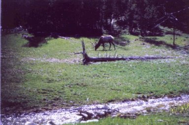
Rock Springs is 90 miles north of the Flaming Gorge Reservoir, known for it's trout fishing.  Head north and you will find the Shoshone National Forest, the Bridger-Teton National Forest, Jackson Hole and Yellowstone National Park.  We'll visit Jackson Hole and Yellowstone soon.

On the trip west out of Rock Springs comes the town of Green River and then the road side stop of Little America.  You have to stop for an ice cream cone....it's a much needed treat and reward for crossing the great American desert.  Stop and read the story.  Southwestern Wyoming has so much early western history, that is is best servered for another venue. It is stories of early fur trappers and American Indians.

Next we will follow the Oregon Trail across central Wyoming.  I'll share another great fishing hole with you.  Till then.....Happy trails!

Wednesday, October 18, 2006

cracking me up

Who would have ever thought I would have my picture in the newspaper for playing the drums?  Of course, I did when I was in the Army but that was really, really different. 


Just a bunch of "old school, old farts" having fun.  The last time we played at the Outlook, people were leaving the hot tub to dance.  Cracked me up!

Here is the entire article:  http://www.dailycamera.com/bdc/business_plus/article/0,1713,BDC_2462_5065271,00.html

Saturday, October 14, 2006

Trick Or Treat Through J-Land

Greetings to all.  Let's have some fun!

Make a journal entry titled "Trick Or Treat Through J-Land"and copy these instructions so others can play along.  Visit as many journals as you can with the "Trick or Treat Through J-Land" title and leave them your link.  Hopefully all those who actively participate will get many trick or treaters and meet some new J-Land pals!

Happy Haunting!!!!


Thursday, October 12, 2006

Southeastern Wyoming


Southeastern Wyoming is the location of the state capitol and my home town, Cheyenne.  How could you be born and raised in Cheyenne, Wyoming and not be a cowboy?  Yes Amanda, I often wear cowboy boots.  The area just west of Cheyenne is where the plains meet the mountains, at least the northern tip of the Colorado Rockies.  The hill between Cheyenne and Laramie is the highest point along the Union Pacific railroad.  There is a monument at what used to be the highest point dedicated the The Ames Brothers of Boston.  They were instrumental in building the railroad.  It's know as Ames Monument.....Duh.  The railroad moved the tracks and left the monument out there all by it's self.  Few people ever see it any more.

Just south and east of the Ames Monument is Remount Ranch.  It was at the ranch that Mary O'Hara wrote "My Friend Flicka", "Thunderhead" and "The Green Grass of Wyoming" in the 1940's.  Bea, I would definitely put this on a "must see" list when you finally visit the west.  If you click on the link to the ranch, you will see the name "Tom Horn" mentioned.  I will cover Tom in another post and my connection to him. 

Laramie sits in a valley,  a high plain located between two mountain ranges. The mountains to the east are conered by Ponderosa Pine.  The mountains to the west and south are covered by Lodgepole Pine (used to make telephone poles).  Northwest of Laramie are the small towns of Bosler, Rock River, Medicine Bow and Hanna.  Medicine Bow is the location of "The Virginian" written by Owen Wister.

A drive to the west of Laramie will take you to Centennial (great skiing) and Woods Landing.  I'll share a secret with you.  Some of the best trout fishing in Wyoming can be found near Woods Landing.  If you go south on highway 230 and cross the Wyoming / Colorado border, there is a dirt road that goes back into Wyoming.  The forest hides the small streams.  If you look hard enough, you will see some streams to the north of the dirt road.  These are the headwaters of the North Platte river that flows into the Missouri River and then into the Mississippi River.  The Brook trout are very tasty and they fit perfectly in the frying pan.  Make sure you purchase a fishing license!

Here fishy, fishy!

OK, my best friend Chris, has reminded me that I forgot to mention Lake Marie, high atop the Snowy Range, west of Laramie.  At over 10,000 feet above sea level, it's cold, very cold.  There are still very deep snow drifts in early June.  Yes, that is snow in the picture and it was taken in July.

Nate and Lake Marie, Wyoming

A prayer

Please offer a prayer for our neighbors Doug and Pam.  Their son, Davis, passed away last night.  He was 12 years old.

Tuesday, October 10, 2006

first snow


Just a quick note to log our 1st measurable snow fall this year.  There is a blue jay and a downy headed wood pecker on the bird feeder.  The wood pecker is hiding on the other side of the 2nd to the left feeder.

Milo does love to run and romp in the snow!


Friday, October 6, 2006

Eastern Wyoming continued


Old Fort Laramie Painting by Alfred J. Miller (1858)

The early pioneers that followed the Oregon Trail entered Wyoming along the banks of the North Platte River.  Fort Laramie is located on the north side of the river.  The old fort served may purposes while it was an active army post and contains much history.  It was a thrill and an honor to participate in a flag ceremony at the fort in June of 1968.  In the movies, you will see the wagon trains in a circle with the Indians attacking, riding around the circle.  In all of my reading I can not find any instance when that actually happened!  There is only one case where the Indians attacked a circle but they did not ride around in circles.


Modern day Fort Laramie

The northeast corner of the state was originally a very large Lakoda Souix Indian reservation.  The discovery of gold in the Black Hills of South Dakota created a demand for land for the white man.  The Indians did not give up their right to the land easily, as General George Custer found out.  Crazy Horse and the united indian nations could only keep the white man out for a short time before the indian wars forced them to live as captives on their own land.  I believe, as the native Americans did, that the land does not belong to man, man belongs to the land. 

The Cheyenne / Deadwood stage trail follows the eastern Wyoming border.  In the early days, before the railroad went north, the stage was the only way into the wild west town of Deadwood.  Lusk is the last community to have a bordello.  North of Douglas, in the Thunder Basin National Grasslands it the town of Bill, Wyoming.  Bill is a very small town.  It has one building that houses groceries, the post office, the jail and out front is a gas pump.  It services all the ranches for miles around.  When I was growing up, the mayor's name was Bill.  He was also the constable, grocer and post master. Much to the surprise of many visitors, there is a parking meter in front of the building.  Some "easterners" are often surprised when they failedto put a coin in this singular device and end up with a fine or even worse, jail.

Thursday, October 5, 2006

A visit to eastern Wyoming


Wyoming's State Capitol building.  Notice the new cars!

I have traveled from Boston to Key West and out to the US Virgin Islands.  Driven from Ocean City, Maryland to Seaside, Oregon. This is a beautiful country with landscapes as diverse as one can imagine. Ask anyone who has driven across Wyoming and a couple of thoughts will be universal.  First, is how dry and desolate it is; there are more Pronghorn Antelope than there are people.  Second, how big it is, almost 400 miles east to west. Third is the wind; it blows all the time (there's a joke in there about Idaho and Nebraska but I can't quite seem to remember what it is).  It is difficult for me to explain several things about Wyoming. 

The concept of space and distance are quite a bit different than what is experienced on the east coast of the US.  I have been called a liar by folks in Baltimore when trying to explain how far you can see.  On a clear day, you can sit just north of the Wyoming-Colorado border, just south of Cheyenne and see the top of Pikes Peak, 175 miles to the south.  With this in mind, I have been perplexed on how to accurately describe Wyoming.  Upon asking friends, I have been given two suggestions.  The first was to read several books by Louis L'Amour.  He has a way about describing the wide open spaces of the American west.  Another friend suggested (and this is the truth) that there are places in Wyoming that you can stand and not see any sign of civilization, as far as you can see in any direction, north, south east or west.  As a matter of fact, you won't see anything except blue sky and grass.  No trees, no nothin'  As funny as this may sound, there is a kind of beauty to it.  When watching "Dances With Wolves", there is a scene when Kevin Cosner wakes up after sleeping under a wagon.  As he stands up, the camera pans the country side.  It almost took my breath away.  I leaned over to Janice and said, "I can almost smell the air, the smell of the sage brush."

With that out of the way, Eastern Wyoming is mostly grass, prairie, farming and ranching.  The two pictures in my last post were taken in eastern Wyoming.  The capitol and largest city(? only 53,000) is Cheyenne, in the southeastern corner. Toward the northeastern corner is Devil's tower.  Some where in the middle is Douglas, home of the Jackalope.  They even have a statue of one in the middle of downtown, but then, that's another story. (I have mine mounted just above my bar)  Now, keep in mind, most folks from Wyoming have a very strange sense of humor.  At least I blame mine on the fact that I was born and raised in Wyo.

Oh...BTW....the character who plays Jack in "LOST" is also from Wyoming.  I don't know him but I'll bet I know someone who does.  You are only one person away from knowing most everyone born in the state.  That's a story I'll share when we visit Yellowstone.

Wednesday, October 4, 2006

The bears have been very active


Southeastern Wyoming

A sure sign of the approaching winter is the increased bear activity.  Almost everyone in Sunshine has see at least one bear, some have seen two or three.  They sure are beautiful, and very graceful for their size.  While Milo and I were on our walk last evening, our neighbor, Julie had a bear story for us.  I'm kind of wishing winter would arrive and the bears would settle in for their long winter nap.  That will come soon enough though. As for now, we have been enjoying a beautiful Indian summer.

The annual Sunshine Community Fest went well.  For the first time, it was held somewhere other than the old firehouse (which burnt down..save the jokes, we've heard them all).  The new firehouse served as a great setting for the dinner and auction.  It's great to see the neighbors and often there is a surprise.  This year the surprise was seeing our neighbor, Brian.  He has spent the last two years in Africa serving in the Peace Corps. The turnout was somewhat dampened by the Great American Beerfest.  A lot of the big spenders went to the beerfest and passed on the auction.  We'll see that doesn't happen again next year.

I just finished reading Kates post and have been inspired.  I love looking at pictures of places I want to visit and have not yet had a chance.  Scotland is one of those places.   

I have been thinking about doing a short travel series about my home state of Wyoming.  As Kate has shared her home with us, I would like to share my corner of the world with you.   I'll bet very few of you have ever met anyone born there.  Of course, you know me!!!!  There are some amazing, beautiful places in the state (and I'm not talking about Wamsutter..inside joke).  I have some of my fathers pictures taken just after he returned from Korea and I'll try to share them.  I also have a connection with the old west and the last person hung in Wyoming.  It's a story about chasing Indians, cattle rustling, Butch Cassidy and The Sundance Kid, and if I keep going, I'll give it all away. So anyway, here's a picture of some of my friends.  I was hesitant about posting the picture.  My old girlfriend may demand equal time and I don't have any pictures of sheep.